This image shows a map of the world where places are rendered comparable in terms of their levels of elevation from sea level. The elevation level indexes the place's vulnerability to coastal flooding per models produced by the NGO Climate Central.This image is from a paper in the science journal Nature Communications by Scott Kulp and Benjamin Strauss who belong to the NGO Climate Central.
According to this image, 35 million people living in coastal Chennai are at high risk of flooding. This image and paper have been highly influential and circulated within global climate policy discourses. This has also been highly cited within public discourses on climate and water shortage in chennai as well. As such the image is an example of what I describe as 'Chennai rendered coastal' primarily through the coastal cities narrative.
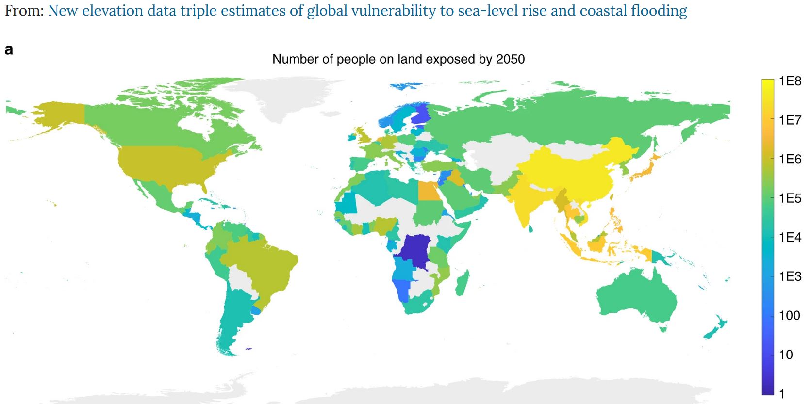